On October 29, 2012, Hurricane Sandy washed into the eastern United States. The storm killed 191 people, razed much of the Jersey Shore, flooded part of Lower Manhattan, and damaged or destroyed 600,000 homes. All told, it caused something like $65 billion in damages and economic loss. Sea level rise alone wasn’t responsible for the destruction, but sea level rise made it worse.
Since 1900, the world’s oceans have risen about eight inches, due both to thermal expansion of the warming waters and to meltwater from glaciers and the Greenland and Antarctic ice sheets. The scientists of the United Nations’ International Panel on Climate Change estimated that by the end of this century, the waters might rise another three feet, and quite possibly more than that. Higher water means bigger surges during storms, which push masses of water ahead of them. Surveying Sandy’s wake, federal and state officials realized that rebuilding the coast as it existed before the last storm wouldn’t help prepare it for the next one.
In 2013, the U.S. Department of Housing and Urban Development launched a contest it titled Rebuild by Design, calling for architects and design firms to pitch their ideas on how to design a more disaster-ready shoreline in New York City and New Jersey, with an eye to protecting particularly impoverished or otherwise disadvantaged communities. Now, five years later, the seven winning project proposals are on their way to real life. One will improve flood protection in Hunts Point in the Bronx; one will create a series of breakwaters offshore of Staten Island; another will reshape the entire southern edge of Lower Manhattan. “Rebuild by Design is leading the way in the development of resilience projects that are not just about brick and mortar,” says New York Governor Andrew Cuomo, quoted in a commemorative book about the project. “They create jobs, promote business and education, and ensure safety in waterfront communities.”
Remember, they are an exotic species in the Western United States, and are rapidly increasing their geographic range and range of habitats. Are they outcompeting or excluding native species in the process? How would we know? We have done almost nothing to monitor changes in the assemblage of mushroom species in areas before and and after the incursion of death caps.
Further Reading
Pringle et al, “The ectomycorrhizal fungus Amanita phalloides was introduced and is expanding its range on the west coast of North America,” Molecular Biology 2009
Lockhart et al, “Simultaneous emergence of multidrug-resistant Candida auris on 3 continents confirmed by whole-genome sequencing and epidemiological analyses,” Clinical Infectious Diseases 2017
Battalani et al, “Aflatoxin B1 contamination in maize in Europe increases due to climate change,” Scientific Reports 2016
Read more: The June 2018 issue of ESTUARY News explores the nine sites, visions, and communities that participated in the Resilient by Design challenge. For a detailed look at each project, plus youth involvement, visit ESTUARY News online.
The contest was the kind of feel-good success story that translates well, disaster or no. After Gil Kelley, the then-director of the planning department in San Francisco, attended a conference about the contest, he returned to the Bay Area wondering if the region could pull off a similar contest of its own. So far, the rising Bay’s visible effects are mostly limited to the occasional king-tide flooding at the Ferry Building—but eventually the rising waters would begin to cause real trouble here, too. Maybe a contest like Rebuild by Design could ultimately help make rebuilding unnecessary.
He put Diana Sokolove, another planning department employee, in charge. She began a research campaign about the Bay, talking to various county governments and regional organizations. “I tried to take the temperature of the region,” she says. “Are people ready for this? Do they want it to happen?” They were, and did. The city partnered with the Coastal Conservancy, the Bay Area Regional Collective, the Rockefeller Foundation, and others and hired the Rebuild by Design nonprofit as a consultant. In June 2017, at a conference on the Oakland waterfront, Oakland mayor Libby Schaaf, Berkeley mayor Jesse Arreguín, Richmond mayor Tom Butt, and other local officials gathered to announce the launch of the “Resilient by Design Bay Area Challenge.”
The contest organizers set out ambitious and idealistic goals: Over the next year, ten teams of architects, engineers, and designers would identify ten especially vulnerable sites around the Bay and would propose design solutions. The teams would bear in mind the connections between healthy ecosystems and healthy communities, between sea level rise and social inequity, between displacement in the future and displacement in the present. They would gather input from scientists, economists, politicians, and local community members, and they would design projects that could actually be built. They would raise awareness of climate change and sea level rise, and they would be creative. The new Resilient by Design put out a request for qualifications, and also a request for suggestions from community members about areas for the designers to focus on. It was a heady moment. Schaaf was quoted in a release from the Metropolitan Transportation Commission (she is also an MTC commissioner): “Now is the time,” she said, “for cities to rise up, and for regions to collaborate.”
In the prospectus that Resilient by Design sent out, it vaguely dangles prizes. “A generous awards program to honor the winning project(s) is currently in development,” it says, “and will be publicly announced as soon as the details are confirmed.” This was perhaps in lieu of lucrative design contracts, because, as the prospectus also noted, “funding has not been identified for the implementation of these designs.” The East Coast’s Rebuild by Design contestants were vying for a slice of roughly $1 billion in disaster relief funding. “The big difference between this process and Rebuild by Design,” Amanda Brown-Stevens, the managing director of the Resilient by Design nonprofit, told me, “is that we don’t have a huge pot of disaster recovery funds.” After the contest was over, the projects might get built, or they might not.
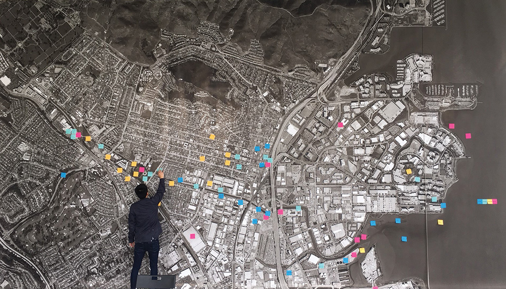
That uncertainty didn’t seem to deter designers, though. By August, more than 50 teams of designers had applied. The Resilient by Design jury (which included designers, urban planners, policy makers, and scientists) selected 10 teams, with members from the Bay Area, Los Angeles, the East Coast, Australia, the Netherlands, Denmark, and elsewhere. The teams submitted their ideas for potential projects, which included artificial lagoons connecting to the Bay, plus lagoonside housing; “hyper-creeks,” which are basically just the creeks that already exist, but rehabilitated; an “infra-cloud,” which is basically just infrastructure except in the cloud, somehow; “micro-deltas,” where creeks (or hyper-creeks) enter the Bay; a new trans-Bay tube from Oakland and Alameda to San Francisco; and many others. Judges matched each team to one “Design Opportunity” out of 10 Bay Area communities or regions for which each would design a polished, final project: Marin City, North Richmond, San Leandro Bay, Alameda Creek, South Bay, South San Francisco, Islais Creek, San Rafael, and San Pablo Bay. The teams would have until May 2018 to come up with one or more projects to improve their location’s resilience and to rally local support, so that the projects would have some chance of continuing after the contest was over. Then they were off.
In effect, preparing for sea level rise means calling a retreat from the water even before it’s obvious to most people that the battle has started. Our impulse for most of the last 150 years has been to do the exact opposite, to charge forward, to get as close to the water as possible. Once, the Bay was ringed by tidal flats and marshes, but by the late 1990s, little of this original shoreline remained, having been diked or developed, turned to pasture or salt ponds. As of 1979, the original 850 square miles of marsh that ringed the Bay were reduced to just 32 square miles. Discontent with the boundaries nature provided, we’ve even piled up fill in the Bay’s shallow edges, building buildings, treating this stolen space as solid ground. The Bay once covered nearly 800 square miles; it now covers just 550.
But the Bay may reclaim much of its lost territory. The National Oceanic and Atmospheric Administration’s sea level rise online viewer shows one vision of the future. As you slide the sea-level rise button to one foot above its present level, the space to the west of North Richmond, between Wildcat and San Pablo creeks, is immersed, along with the space north of San Pablo Creek. The sea also nibbles the edges of Milpitas, Sunnyvale, Mountain View, Palo Alto, Redwood City, San Bruno, Santa Venetia, Novato. At three feet of sea level rise, which is about the median level that the scientists of the UN’s Intergovernmental Panel on Climate Change predicts by 2100, the runways at the San Francisco Airport disappear under the water, along with parts of Treasure Island and most of Suisun City. The water approaches Napa, Petaluma, and Martinez; Belvedere Island, at present more of a peninsula, begins to live up to its name. At six feet, which is the maximum shown by the viewer but is still less than the most extreme projections of sea level rise by the end of the century, the water has reached Richmond Parkway. It’s flooded large swaths of West Oakland and Alameda, the Oakland Airport, the Coliseum, and San Francisco’s eastern shore. The Louisiana shore has retreated back to Baton Rouge, and Miami is part of an archipelago.
Mark Stacey, a professor of environmental engineering at UC Berkeley, described one of the ways that Bay Area communities might collectively respond to the rising waters. He pointed to Foster City, a town of about 34,000, located on the west end of the San Mateo Bridge. The entire town is built on fill. In 2014, the Federal Emergency Management Agency, which designates which parts of the United States are flood zones, informed the town’s government that its riprap levee wouldn’t protect it in the event of a 100-year storm. (FEMA’s levee failure prediction was based on improved modeling, not sea level rise, says Patrick Clancey, a FEMA project manager, but Stacey says the example here applies all the same.) If FEMA designated the town as a flood zone, owners of any homes with federally backed mortgages would need to carry flood insurance, which could cost them thousands of dollars every year. To prevent both that unpleasant cost to its residents and the even more unpleasant possibility of the entire town flooding, the city council voted in March to put on the ballot a $90 million bond to raise the levee. City engineer Jeff Moneda says the bolstered levee would protect the town through at least 2050. In June townspeople overwhelmingly voted in support of the bond.
Foster City’s response, Stacey says, is the logical thing to do: “The financial risk is new and immediate. They’re going to raise their levee a little bit. It’s a completely rational decision for them to make.” He says the following set of events would also be completely logical: Sea level continues to rise, and one by one, each bayside community faces a situation similar to that of Foster City, maybe with actual flooding or maybe just the threat of rising flood insurance. One by one, they all build or bolster their levees and seawalls. But then, finally, the entire shoreline of the Bay is ringed in by levees and seawalls, and we find ourselves in an accidental New Orleans, completely cut off from the Bay, forced to work harder and harder to defend ourselves from it. It’s a place nobody wants to build that we might build anyway.
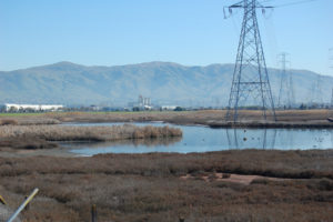
In mid-April, I attend a community meeting at the Multicultural Senior and Family Center in North Richmond, northeast across the Bay from Foster City. The neighborhood was built during World War II, settled mostly by African Americans who came to Richmond to work in the shipyards. Fenced in on the east side by the railroad tracks and the west by Richmond Parkway, the low-lying area is unincorporated, a Vatican City–style island contained within the City of Richmond. It relies on Contra Costa County for infrastructure and emergency services. Two creeks run through the community—San Pablo to the north and Wildcat to the south. Sea level rise will reduce the downhill grade of the creeks, making them more likely to back up during storms and overflow into town.
The meeting is put on by one of the design teams, the Home Team, headed by Mithun, a design firm with offices in Seattle and San Francisco. When I arrive, about 20 people are huddled around three long tables. Along with the usual senior center information about bus passes and Internet training, one of the signs on the wall summarizes what would happen during a chemical leak from one of the area’s refineries; in 2012 the nearby Chevron refinery caught fire, sending gouts of black smoke washing over the town.
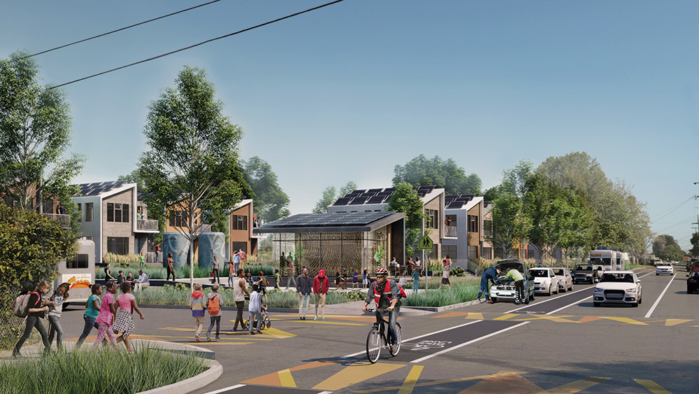
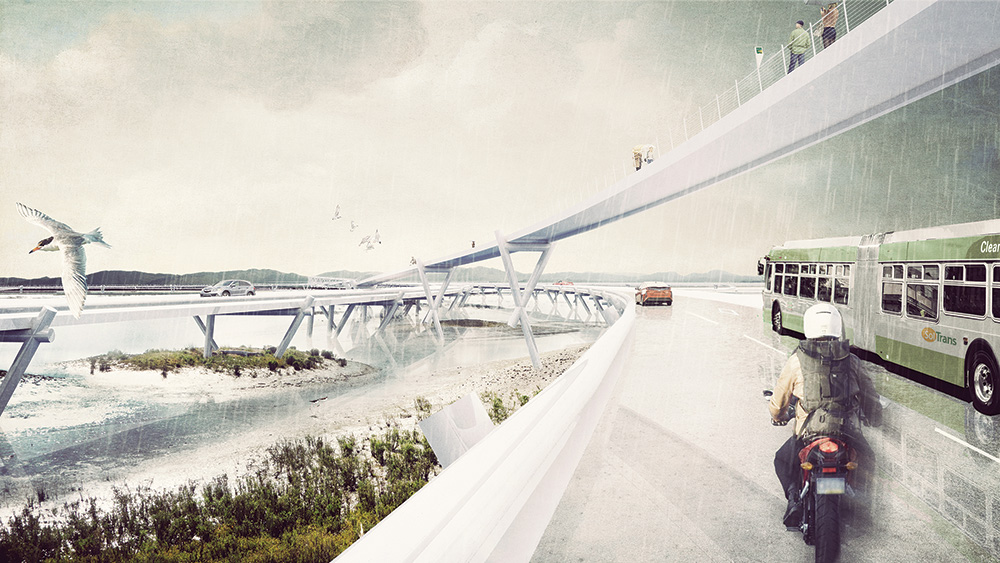
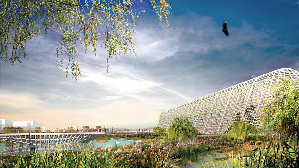
The people at the tables include members of Mithun, employees of Contra Costa County, and members of the community advisory committee that the Home Team has assembled (and paid stipends to) to get their input on their resilience projects. This is their fifth and final time meeting before the Home Team presents its projects to the Resilient by Design jury. Right now, they’re studying colorful posters that show three of the projects the Home Team is proposing. The first is a “horizontal levee,” a wide, gently sloping strip of coastal land that would serve the same purpose as a more traditional, wall-type levee, but would also provide space for buffering coastal marshes to migrate inland as the Bay water rises. This would go between Wildcat and San Pablo creeks, at the very edge of the Bay, and would protect both a wastewater treatment plant and an industrial park to the west of town. The second project is an upgrade of the trail that runs along Wildcat Creek. An improved trail would connect the Richmond BART station and the center of Richmond to the east and the Bay Trail to the west via a new pedestrian bridge over Richmond Parkway (four to six lanes, speed limit 50 mph). The third project is simply an effort to provide more affordable, community-owned housing, as well as “20,000 Trees of Justice,” to be planted along Richmond Parkway and in groves throughout the community.
Right now, it seems that sea level rise is not the most concerning thing about living in North Richmond. When the meeting breaks into group discussion, a man in a maroon suit named Henry Clark, whom everyone calls Dr. Clark, points out that the pedestrian bridge over Richmond Parkway might attract sketchy characters. North Richmond, he says, is where people come to pick up prostitutes, to buy drugs. The community is plagued by violence.
“We haven’t talked too much about the public safety aspect of it,” he says. “That has to be part of it.” After the general discussion people around the room take turns talking about what they are most excited about, which, mostly, is affordable housing. “I definitely like all the ideas,” says Princess Robinson, one of the community advisers. “I just had a question—can you do all three? Or are you just choosing one out of the three?”
“I think all three have ways forward,” says Debra Guenther, a partner and landscape architect at Mithun, “but it’s definitely going to be a collective effort to figure out how that happens.”
At times, the design team and the people they are designing for seem to be working toward somewhat different goals. Partway through the discussion, Guenther asks what the group thinks of the title the Home Team came up with for the project: “R-Home.” The letter R, Guenther explains, can be read as either “our” or “Richmond” or “reclaiming.” “We’d love to hear if that sounds right to people,” she says.
“I feel like it’s less important,” says Sequoia Erasmus, director of community engagement in the office of Richmond mayor Tom Butt. “It helps your branding, but I don’t know if it should be decided right now.”
“I’m not too sure about the catchy phrase,” Dr. Clark says.
After the meeting, I ask Dr. Clark about sea level rise. He was born in North Richmond in 1944 and has lived here ever since. “I don’t think a lot of people in this community really know about sea level rise in a global sense,” he says. “But they do know about flooding.” Until about 10 years ago, when the county raised a levee around the north edge of town and widened the creekbed, San Pablo Creek often overflowed, flooding part of the town. “Every time it rained,” he says.
I have to confess: A part of me wonders about the whole Resilient by Design contest. I wonder—in a world of climate change and melting ice sheets and extinction and overpopulation and political stagnation—about how a design contest with no money attached to it really changes the balance. I wonder whether a few months is actually enough time for the teams to come up with anything meaningful and new, and also whether there will ever actually be something called a hyper-creek. I wonder whether anyone but a designer gets excited about a design contest.
I ask Andy Gunther, a member of the contest’s scientific advisory panel, whether the contest really matters, and he acknowledges that some people would be cynical about it. “Designers, they’re really good at drawing these pictures. There’s always smiling people in these pictures,” he says. But Gunther, like most everyone else I spoke with about Resilient by Design, sees the contest in a more charitable light. He says it would be useful even if none of the projects get built: “In 10 years, we’ll look back and say, ‘Are any of these designs under construction?’ I don’t know, but I do think the images they create, the designs they create, are going to help us think in new ways about the future Bay Area, and I think that is a very valuable product.”
John Rahaim, the San Francisco planning director, agrees. “Some of the designs will be quite bold, and people will roll their eyes and say we can’t do them,” he says. But by pushing the bounds of what’s realistic, he adds, the designers might come up with something new and useful. “The entire planet will have to deal with this in some fashion, so as a starting point, why not get some great minds on it?”
Robin Grossinger, an S.F. Estuary Institute senior scientist and member of the scientific advisory panel, cautions against judging the contest’s success by the number of its projects that get built. “It’s going to take an inordinate amount of resources, money, public will, adaptability, flexibility, creativity to solve the challenge of redesigning the shoreline,” he says. “We don’t have all that assembled yet. So I think, [regarding] Resilient by Design, it’s not fair to ask them to solve that whole problem.” Instead, he suggests, judge the contest by the usefulness of its ideas. It’s easy to imagine how we wind up further cut off from the Bay, living in accidental New Orleans, surrounded by water but separate from it, hostage to it. The task of Resilient by Design, in a sense, is just to imagine how we don’t.
The members of the Home Team, at least, seem earnest about the solutions they are proposing. A week after my visit to the North Richmond community meeting, I join Mithun’s Debra Guenther and Tim Mollette-Parks at the company’s offices in San Francisco’s Financial District. They discuss small tweaks to their plans, incorporating suggestions from community members. They talk about steelhead-spawning habitat and traffic dynamics at crosswalks, county zoning and native trees, eelgrass and potential sources of sediment for marsh construction, along with the video that they’ll use to present their projects to the Resilient by Design contest judges. Sea level rise, it’s worth pointing out again, is tremendously complicated.
As the meeting is wrapping up, Sandy Mendler, a principal at Mithun, comes into the room to tell me about the firm’s plans for creating affordable housing in North Richmond. By subdividing plots to create denser housing, taking advantage of the area’s wealth of abandoned buildings, and using local labor, she explains, the community would boost local ownership, begin a “cycle of reinvestment,” and hopefully prevent the gentrification and displacement that often accompanies redevelopment. Community-owned housing isn’t a new idea, exactly, but she explains it with an intensity and depth of detail that defies skepticism.
But again, there is the problem of funding. This is less certain. Some of the money might come from federal housing grants, Mendler says, or be lent by banks. There are local housing programs, too, that might help pay for some of the work. Earlier, when I asked Amanda Brown-Stevens, the Resilient by Design managing director, about where the contest’s projects might find funding, she mentioned Caltrans climate adaptation grants and Measure AA. The measure, which Bay Area voters passed in 2016, uses a $12 parcel tax to raise $500 million over the next two decades for shoreline projects around the Bay. “The region was willing to tax itself for restoration and climate efforts,” she says. “That really showed the potential to actually implement projects without relying on disaster relief funding.”
Larry Goldzband, executive director of the San Francisco Bay Conservation and Development Commission (BCDC), says members of the commission plan to meet with Resilient by Design teams, to help advise them on how to carry their projects forward. “We want them to graduate from the project and have somewhere to go,” he says. Compared to the entries in Rising Tides, a design contest that BCDC put on a decade ago, Resilient by Design’s projects seem both useful and feasible, he adds. (One of the entries in the earlier competition was an inflatable bladder that would seal off the entry to San Francisco Bay.)
Still, even with widespread support, funding will likely be a challenge. “This is an enormous problem that will come with an enormous cost,” says John Gioia, a Contra Costa County supervisor whose district includes North Richmond; the Resilient by Design contestants aren’t the only ones who may struggle to find funding. But Gioia wouldn’t rule out some of the projects actually getting built. “We can’t get the money if we haven’t fully planned what we want to do,” he notes. “So you know, we start one step at a time.”
In early May, I make another trip to Richmond, this time to Point Pinole. At the urging of Paul Detjens, a senior civil engineer at the Contra Costa County Flood Control and Water Conservation District, I walk from the parking lot, across a bridge over the railroad tracks, and out along the Bay Trail to the Dotson Family Marsh. The marsh, long the target of developers, was acquired by the East Bay Regional Park District in 2008 and reopened in the spring of 2017, after a $14 million restoration. As part of the restoration, workers graded the marsh so that its floral inhabitants could slowly migrate uphill, like in the horizontal levee that the Home Team is proposing for the area north of San Pablo Creek. As the sea level rises, the plants will push inland toward the railroad tracks, but won’t disappear, at least not in the next 80 years. “It’s a park that’s going to be resilient for generations to come,” Detjens says. “They put a lot of thought into that.”
Today, the elevated concrete walk that runs across the inland edge of the marsh, parallel to the railroad tracks, is nearly empty. Back across the tracks, I can see the rooftops of low-lying Parchester Village. To the south, I can see the spires of the Chevron refinery. The marsh itself, at present four or five feet below the walk, looks natural, in the normal scrubby-marshy way; if Detjens hadn’t told me it was also a carefully sculpted park, I wouldn’t have figured it out on my own. Little alluvial channels run toward the Bay, a couple feet deep, showing the distance to sea level.
I look out across the water, at the point of Mount Tamalpais, then down at the edge of the Bay, now 400 miles long but getting longer. The Resilient by Design teams unveiled their projects on May 17th in San Francisco. They proposed upgraded schools and paths, expanded parks and elevated roadways, and, of course, a hyper-creek. Some of the projects might be built as proposed. Some might be used as inspiration for other, later projects. Some might even be replicated around the Bay, as the marsh/horizontal levee behind me will likely be. Others will probably be just a pretty design.
I climb over the pieces of asphalt, descending a final few feet. I’d hoped to reach the Bay itself, to stand at the place where the sea meets the land, but the tide is out and there’s just mud. The water is still far away.